Central Idaho is one of the best hiking and mountain biking destinations in the West. The McCall area alone has more than 500 miles of public trails, 300 lakes and 1,400 miles of streams to explore. With so much territory to cover, it is sometimes hard to know where to start hiking in McCall. If you are after a day of hiking, here are a few of our favorite trails:
East Fork Lake Fork Creek (Moderate)
This is a good hike for kids along the creek where there are interesting rocks to climb and a few hidden fishing pools, and is under shade for most of the hike. The full hike is 13 miles out-and-back, but a hike .8 miles in to an unsigned junction is the perfect turn-around point for a short hike with amazing scenery.
Louie Lake & Jughandle Mountain (Moderate)
Designated as a trophy lake, Louie Lake is backdropped by the magnificent cliffs of Jughandle Mountain. The trail in to the lake is 2 miles long, and is a steady uphill hike. To make a loop, continue onto the Jughandle trail over to Boulder Lake. The loop is 6.8 miles long and passes 3 lakes: Louie, Boulder and Boulder Reservoir.
Twin Lakes (Easy)
(Trail #165) This trail involves a 1-mile walk up to the Twin Lakes. It climbs steadily but not steeply for an elevation gain of about 400 feet. Fishing is good, however the lake is subject to drawdown at the dam so you will want to go early in the season. It’s a fun place to take the kids for a picnic.
Hazard Lake(s) (Easy)
(Trail #169) There are three Hazard Lakes: Hazard Lake, Upper Hazard Lake and Big Hazard Lake. All three are popular fishing lakes. The one-half mile walk to Big Hazard Lake is flat and suitable for most people. The trail to Upper Hazard Lake is a bit more strenuous, covering 2 miles, and gains about 348′ in elevation, starting at 7080′ and ending at 7400′. The hike to Upper Hazard Lake is a perfect hike for children and seniors because of its relatively flat terrain.
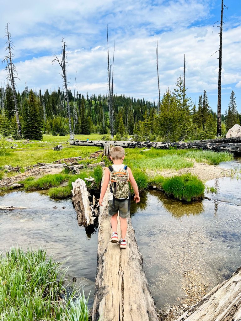
Twenty Mile (Moderate)
(Trail #085) This trail winds for six miles through the burn of the 1994 Corral/Blackwell fires and takes hikers to the Twentymile Lakes. The first three miles of the trail are relatively flat, then climbs steeply for the last three miles.
Duck Lake & Hum Lake (Moderate)
(Trail #085 and Trail #082) Duck Lake is a short hike of approximately 2 miles round trip. It has little elevation gain and makes an ideal hike for most ages and abilities. Hum Lake trail takes off from Duck Lake and is a three-mile one-way hike with about a mile of steep grade. It takes hikers over a ridge, into a meadow and to the glacial Hum Lake.
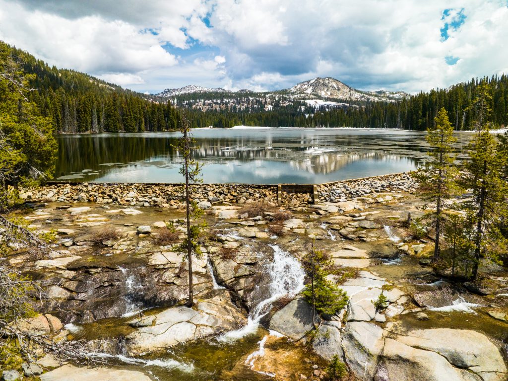
Goose Creek Falls (Easy)
(Trail #354) In a little over a mile, this trail takes hikers to Goose Creek and the waterfall. The first portion of the trail goes steadily downhill until it reaches Goose Creek Bridge and is not recommended for small children. Unlike most trails which gain elevation, Goose Creek Falls Trail starts at 5760′ and drops to 5080′.
Box Lake (Moderate)
(Trail #110) The starting elevation is 5680′ with an elevation gain of 1863′ and a 343′ drop from a ridge to the lake. This trail is 3.5 miles long and suggested as an overnight hike for many people especially if you plan on fishing and swimming. The trail switchbacks 800 feet in the first mile and continues to be steep for another mile.