By Samantha Sais, all photos credit Samantha Sais
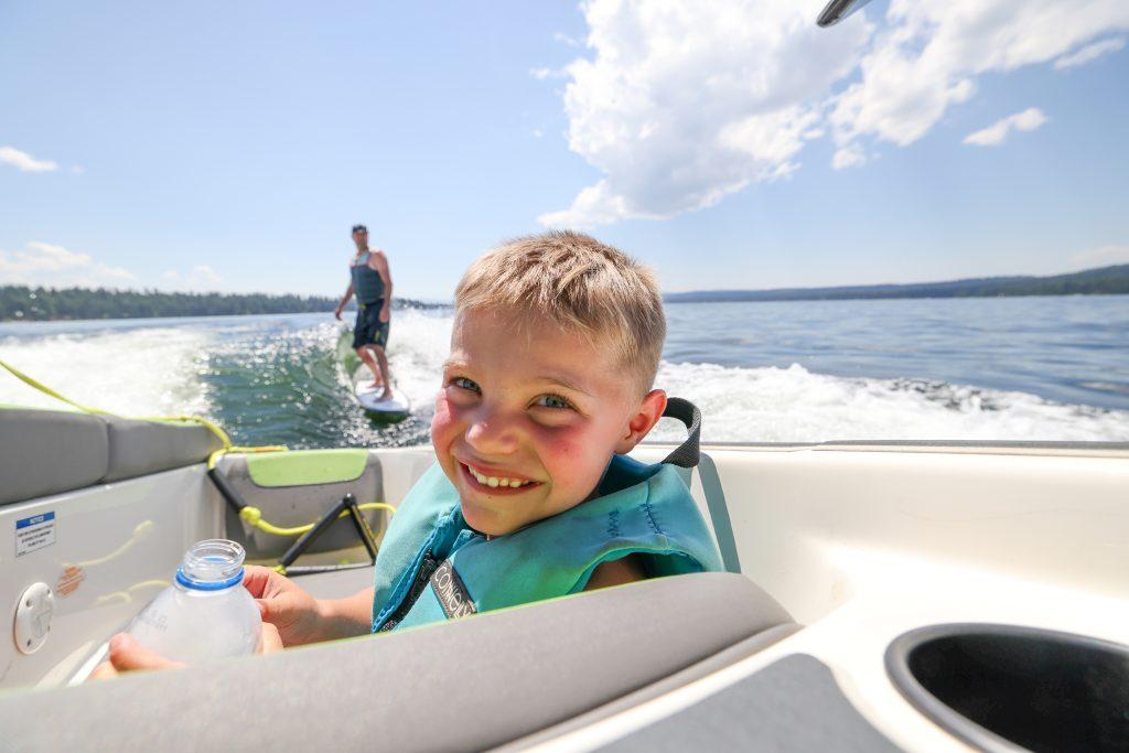
The rivers of Idaho offer an enormous variety of accessible whitewater rafting, perhaps more than anywhere else on earth. Whether you are seeking a moderate class II-III, or are kayaking some serious class V, there’s a world-class section of river for everyone, and a guided outfitter in every corner of the state to take you. If you have the time, the gear, and the skills to coordinate your own self-supported river trip, then Idaho has many rivers to choose from.
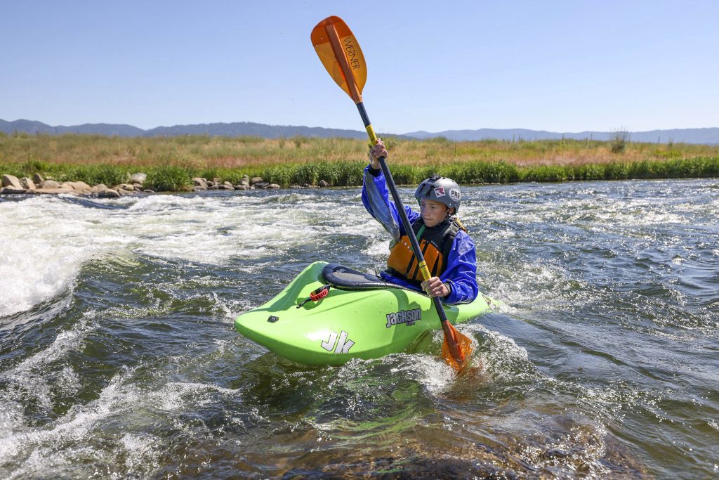
Locally, McCall’s whitewater options focus on day trips along the Payette River. The North Fork Payette Cabarton class III section, just south of Cascade, is an 11-mile stretch that provides a continuous, scenic day trip, and ends with the climactic Howard’s Plunge. Downstream, the Payette’s Staircase section offers a steeper, more exciting five-mile roadside run to the town of Banks. This stretch is not for the faint of heart or inexperienced and is essentially a class III – IV rapid from start to finish. The Main Payette, or Upper Main, begins in Banks, offering a popular and splashy seven-mile class III float to the Beehive take-out.
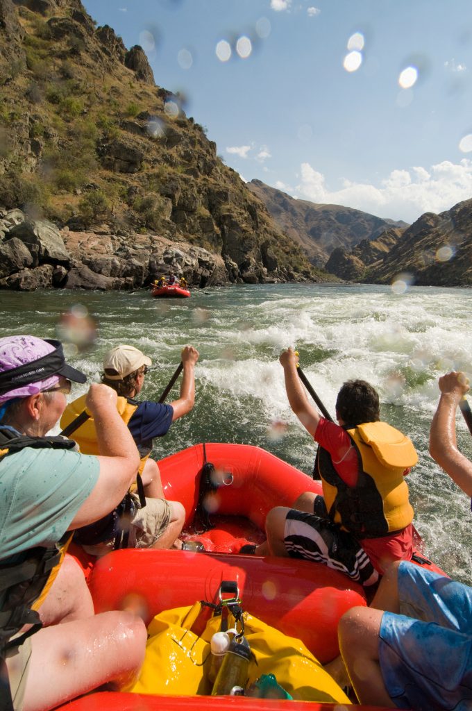
For multi-day trips, head further into the mountains for the classic river experience. Idaho’s Salmon River, known as the ‘River of No Return’ starts near Salmon, Idaho at the mouth of the Middle Fork of the Salmon. The Salmon, known as The Main is an 80 mile, five-six day expedition, starting just west of Salmon and ending upstream of Riggins at Vinegar Creek. The Salmon’s pool-drop characteristic offers huge volume, and class III-IV wave trains and holes, capable of swallowing a large raft at higher flows and making for one epic experience on the water. Experienced outfitters and guides based in McCall and Riggins offer several multi-day trip options.
However, there is one stretch of the river revered by all, the quintessential “gold standard” for river rafting…the Middle Fork. In the heart of the Frank Church River of No Return Wilderness – the lower 48’s largest federally protected wilderness area – lies the Salmon river’s largest tributary, known as the Middle Fork.
The Middle Fork is perhaps the most coveted multi-day river permit in the world. While several rafting companies offer guided trips, many opt to seek a private trip. A private permit is only awarded to a lucky applicant under Idaho’s 4 rivers lottery permit system. According to the USDA, in 2020, the Middle Fork had more than 17,000 applicants, and only 387 permits, which gives each applicant a 1-in-45 chance of winning.
I was lucky enough to be invited on one such private trip and it is an experience I won’t soon forget.
Hitting the Jackpot
Pulling a Middle Fork permit is basically like winning the outdoor adventure lottery. And for a private trip, the permit holder gets to select who comes along on this once-in-a-lifetime adventure. The crew typically consists of some old boater friends, some new acquaintances, and some capable bodies. If you’re lucky enough to meet one of these criteria and get invited, then clear your schedule and pack your dry bag. If you have your own boat or bring other talents to the table, even better.
So, you’ve been invited. The crew has been chosen. Logistics are passed around, funds are met, and inventory is gathered. The launch date is approaching and the excitement for adventure is drawing near. Eventually, the car is packed, and you head out to leave the rest of the world behind.
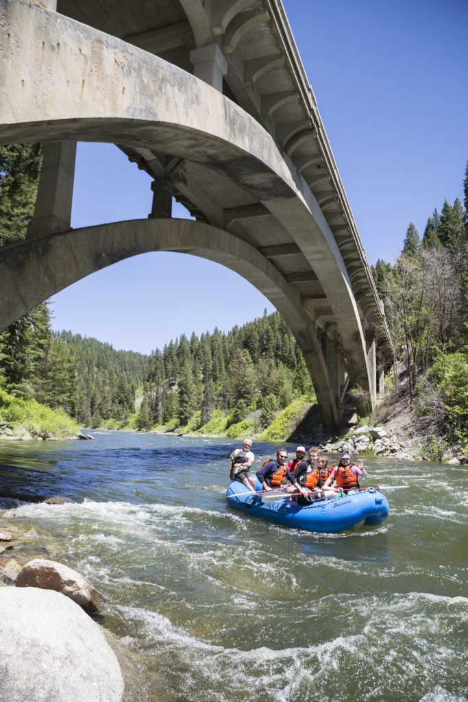
The Launch
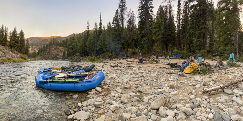
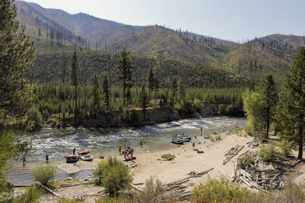
The Middle Fork’s 100 mile, free-flowing, crystal clear water is among the longest, un-dammed, uninterrupted bodies of moving water in the country. Typically floated in six to eight days, it is a major commitment. From May 28th to September 3rd, only seven permits are launched per day, private and commercial. The day prior to the launch, each trip leader must reserve assigned campsites for each night of the trip. The daily itinerary for every day on the river is planned around the distance from each camp. On night two, you may get that large sandy beach with a waterfront tent site. On night three, maybe a small, wooded site surrounded by hot springs. Each camp offers a unique perspective of the river canyon.
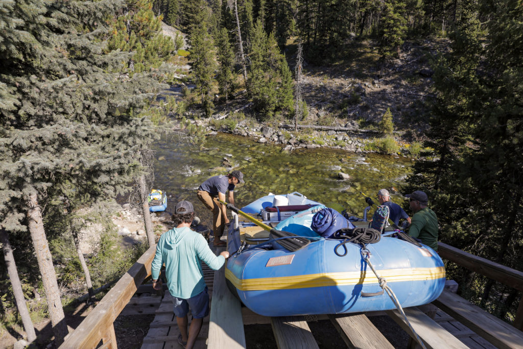
From the Boundary Creek launch site, the Middle Fork begins in a cool, lush alpine forest and although recent fire activity has left much of this forest burned, lodgepole and Douglas Fir still line the river’s edge. Prior to each trip’s launch, the Ranger educates the group on several topics including fishing and fish habitat, historic artifacts and archeological sites, and overall river etiquette. Once boaters finish rigging at Boundary Creek, the first contact with the water begins by sliding your boat down a long, steep ramp, sometimes requiring lowering your boat into the river by rope. Once the boat splashes into the water, this marks the true beginning of the adventure.
Daily Action
During the first 25 miles, the river is continuous and technical. Small creeks and hidden waterfalls spill into every corner of the river, and the flow increases with each mile. The action begins immediately. There is no warmup on the Middle Fork. Large, named rapids, such as Velvet Falls, may want to be scouted at most flows, and they feature large drops or boulders to navigate through. Other, unnamed rapids should not be underestimated and require close attention.
During our late-season trip, this section turns into a channelized boulder garden. The real challenges are choosing the right channel, not getting stuck, and not snapping an oar between the rocks. Many experienced with these flows deflate their floors and run the rafts soggy to noodle over the shallow, rocky river bottom. Even the most experienced boaters need a partner with a strong back to help push off rocks. The entire trip looks out for one another, waiting and setting safety for hang-ups. Some may shy away from late-season trips, but in my experience, they’re missing out on the action.
Once you are through the narrow and steep S-shaped drop at Pistol Creek Rapid, you’ve officially made it through the upper 25. At this point, around day three for our trip, the Indian Creek Ranger station offers an alternative launch for those who may want to avoid the upper section during extremely high, or very low flows. Permit holders may fly in with their crew, gear, and boats. Sometimes additional supplies are flown in here to lighten the load on the upper section.
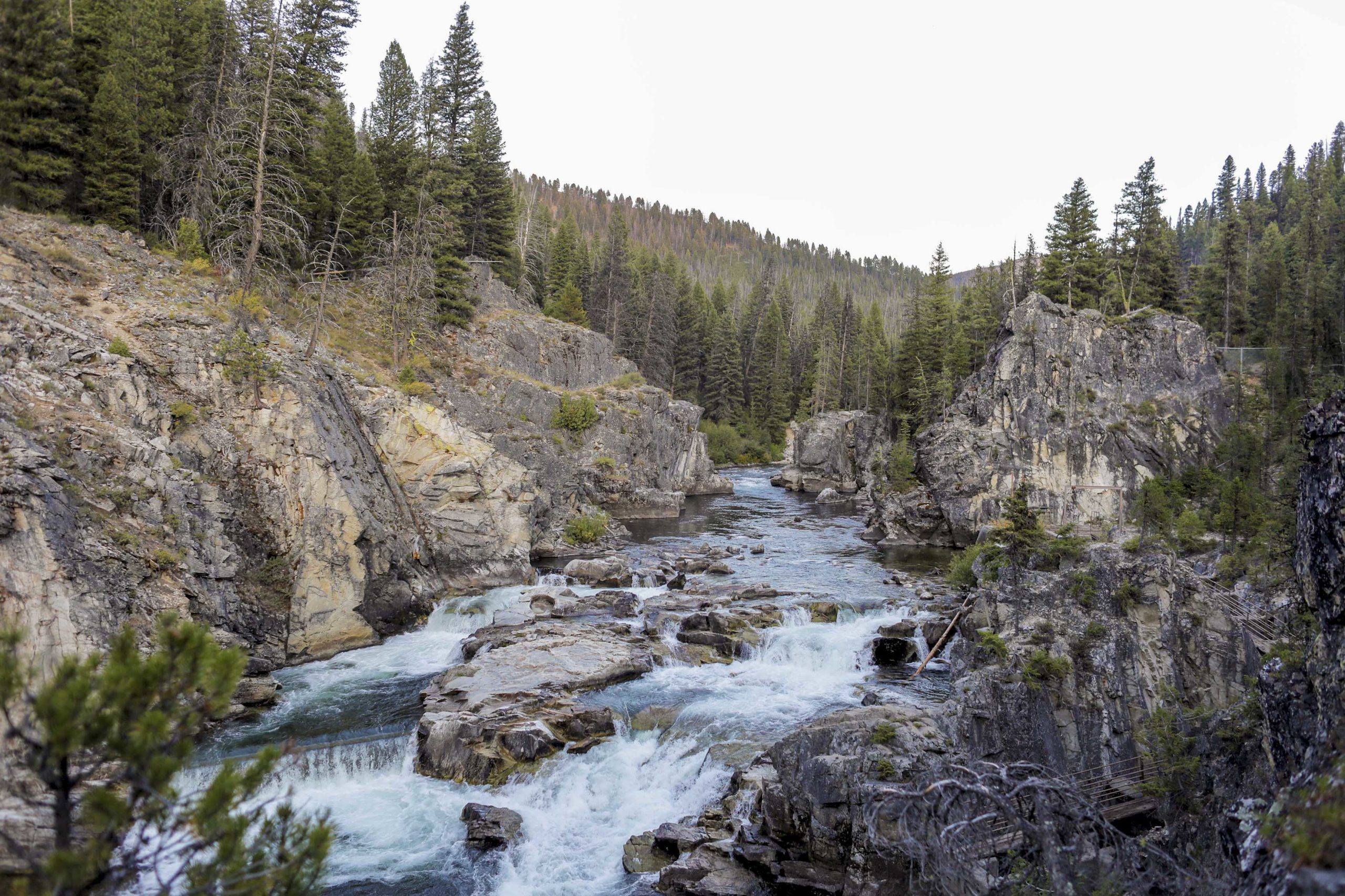
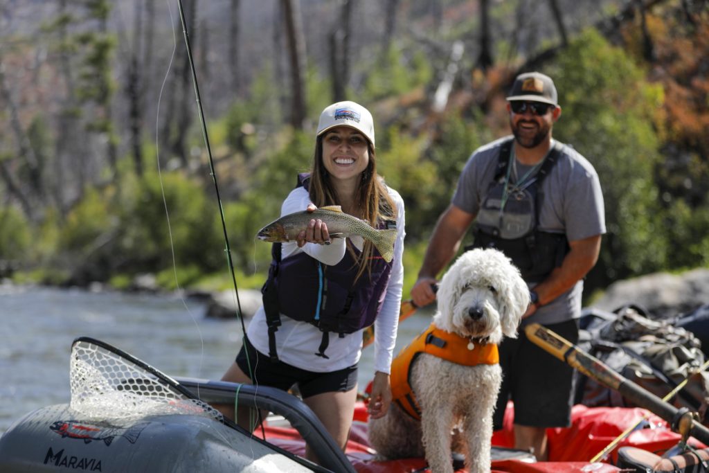
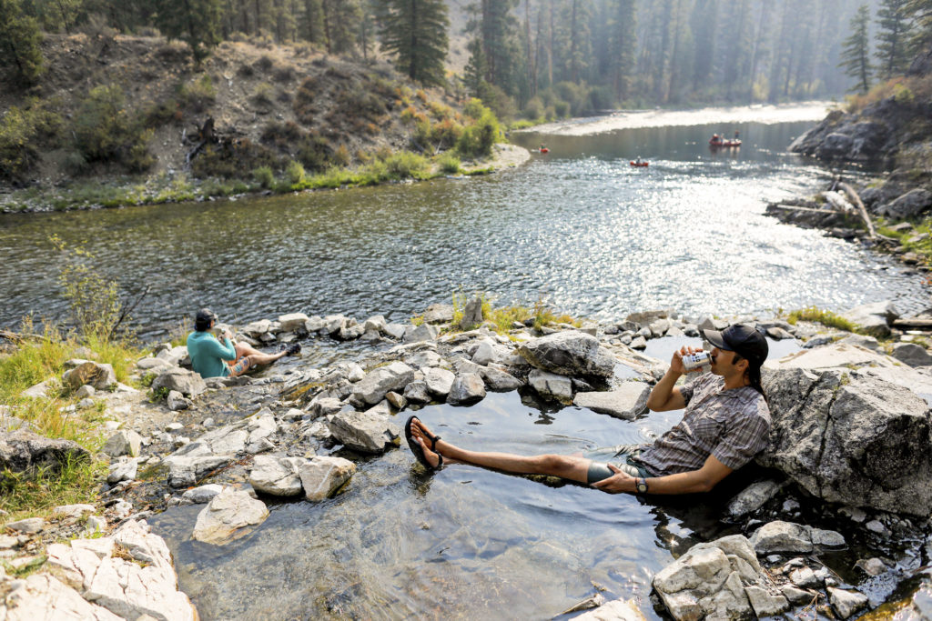
Indian Creek also marks the transition from the upper, dense, forested section to the more open, dry, middle section, where larger tributaries and hot springs enter the wide, sloping canyon walls. Hot springs are created by the pressure from the many layers of the surrounding rock. As water from rain and snowmelt work their way deeper into the earth, it heats up. Water heats up at a rate of 2 degrees for every 100 feet of depth. Pressure from the rocks pushes the water back towards the surface. The water carries minerals from each rock-type. Some of these minerals in combination with sulfur, create a stinky, rotten egg smell – but the hot springs on the Middle Fork aren’t the stinky kind!
During our trip, I found that one of the most fascinating aspects of the Middle Fork, and something that separates it from other rivers of this length, is its continuous flow. The current will help push you along from top to bottom. This allows for a craft unique to the Middle Fork, the ‘sweep’ boat. The sweep is a large (up to 28 ft long) gear boat used by commercial outfitters. The oars are positioned on the bow and stern and swing sideways in a sweep-like motion. The guide stands in the center on a deck platform surrounded by baggage. This design does not allow for forward momentum, but it gives a boat this size a huge advantage with side-to-side maneuvering. An impressive sight as a spectator to see these beasts in motion.
One of the best parts of each day is arriving at camp. There seems to be a natural ritual every day when our feet touch dry land where we all get a moment to share with our fellow travelers and reflect on the day. Often, this is followed by smaller groups splitting off to eventually be with themselves and absorb the river atmosphere before returning for the highlight of camp…dinner. The kitchen is set up and food and refreshments are pulled from coolers. Each crew member takes a turn presenting their chosen camp cuisine. Your appetite tells you it is the most satisfying meal in memory. Dinner is flavored by the essence of the outdoors and the company around you.
History on the River
Days on the river are broken up with hiking, hot springs soaking, and exploring the amazing history of the area. There is always something to see of significance on the Middle Fork.
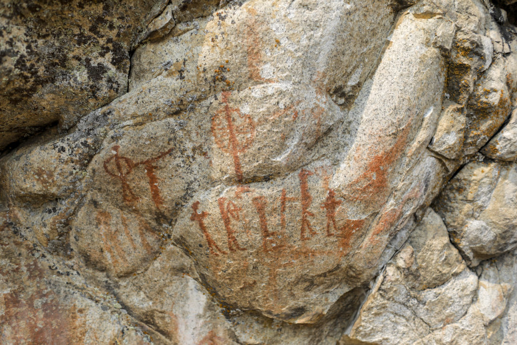
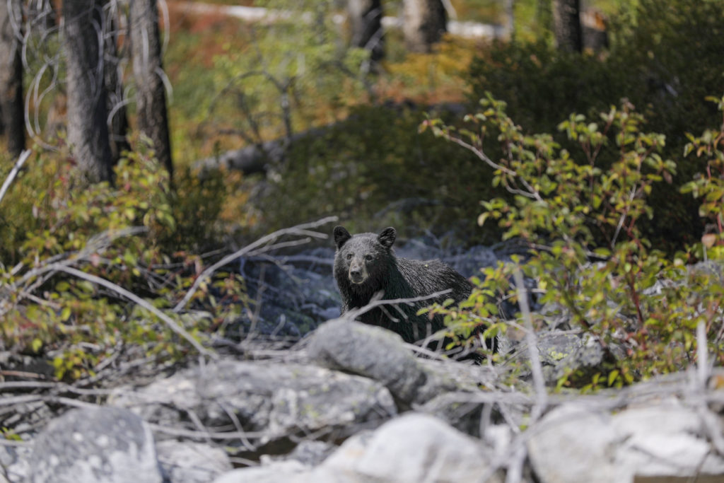
Hiking and historic artifacts can be found on old homestead sites, marking humanity’s earlier attempts at settling the area. Some settlements paint a clear picture of how tough full-time settler life was in the canyon. There’s an obvious awareness of one’s total isolation and self-reliance. Many prehistoric native habitants left their markings on canyon walls, showing evidence of an ancient hunter-gatherer civilization. Early Shoshone and Nez Perce Native Americans lived in small villages along terraces above the river. The tribes were known to have occupied the isolated canyon as long as 8,000 years ago. All early settlers of the canyon were known to have little to no contact with life outside of the canyon.
For every modern visitor, we have an opportunity to disconnect and reconnect to a simpler time, and to put our devices and real-world obligations aside to remember our place in the natural world. The river canyon is a refuge for anything that may be missing from our normal lives. Our experience depends entirely on what we bring to it.
Keeping it Wild
The Middle Fork was not always as pristine. From the effects of its early gold-rush history and heavy grazing from cattle and sheep ranchers, the river saw its latest transformation during the Wild and Scenic Rivers Act of 1968. This act helped in preserving our wild rivers, promoting public participation, and recognizing the potential for the river’s appropriate use.
After the Wild and Scenic Rivers Act was passed, much of the surrounding wildlife ecosystem has returned, and the river’s water clarity, litter, and fish habitat have seen major improvements. As disheartening as the lottery permit system may seem as an applicant, it has helped tremendously to lessen the impact of river recreation on the environment. The permit helps to control the flow of visitors and enforces rules and regulations to help preserve the habitat. From my experience, all boaters take pride in having good etiquette. The camps are clean, and there is no trace of their use, boaters always leaving their camp better than they found it.

Going Out with a Splash
Tappan Canyon marks the beginning of the lower stretch, where the sloping canyon walls enter the steep, talus cliff banks and the whitewater action picks up again. The lower canyon geology is the most dramatic. In Impassable Canyon, the final segment of the Middle Fork, you pass beneath the second deepest canyon in North America, where 2,000-foot cliffs tower over the river bottom. The last few miles consist of stunning views, vertical walls, and huge, technical rapids, pushing you into steep, narrow corridors, and polished sculptures in the rock. After the grand finale of whitewater, you are only a couple of miles from the end. The Middle Fork tapers out into a mile-long straightaway and enters the Main Salmon on its journey to the ocean.
For me, this last stretch is representative of the entire trip. Big whitewater and grand stories to tell, paired with quieter moments, reflection, and a deeper appreciation for this wild place. That is perhaps why the Middle Fork is such a sought-after trip. You get so many unique experiences wrapped up into one adventure on the water. Pure Idaho gold, right there.